About
The European Space Agency (ESA) Polar+ Ice Shelves project will exploit the 25-year record of ESA satellite observations to generate new measurements of ice shelf thickness change, ice speed, crack propagation, area change, and surface and basal melt across Antarctic Ice Shelves. These new datasets will reveal small scale ice shelf features such as the propagation of cracks along the ice shelf surface, deep sub-shelf meltwater channels that can erode ice locally by up to 200 meters, and changes in the calving front and grounding line location. These datasets will improve our understanding of the way in which ice shelves around Antarctica are changing today, which we will use to discover new insights about the physical mechanisms driving change and affecting the future stability of ice shelves in this remote and inaccessible continent.
The aim of this project is to produce a suite of Earth Observation datasets
to characterise how ice shelves in Antarctica have changed over the last
decade, and to make use of these data sets to investigate the physical
processes driving this evolution.
The project consortium is led by the University of Leeds (GB), in collaboration with DLR (DE), Finnish Meteorological Institute (FMI) (FI), ENVEO (AT), EarthWave (GB) and the University of Edinburgh (GB). The project kicked off on the 1st September 2020, and is funded until 2022.

Ice Shelf thickness and basal melt
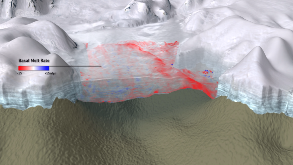
As part of this project, we will make measurements of surface elevation and its time-dependant evolution at an unprecedented spatial and temporal resolution, from radar altimetry satellite data. From these, and in combination with ice velocities and climate reanalysis, we will generate ice shelf thickness and thickness change. Finally, from mass conservation, we will derive the location and magnitude of melting at the base of Antarctic ice shelves.
Ice shelf velocity
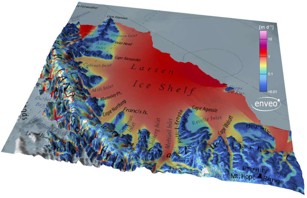
The launch and dedicated Polar acquisition plan of the Copernicus Sentinel-1A and -1B SAR satellites marked a transition from traditional campaign-style observations, to truly operational monitoring of ice flow in the Polar Regions. The nearly continuous repeat-pass coverage of the ice sheet margins in critical sections of the Antarctic coast, since October 2014, has enabled the development of a state-of-the-art ice velocity retrieval algorithm to acquire a dense archive of ice velocity maps of Antarctica. An improved data set of ice shelf velocity corrected for tidal effects is now generated by ENVEO within the ESA Antarctica CCI+ project. In this project we will exploite the innovative tidally corrected ice shelf velocities and test new InSAR applications for ice shelves.
Ice Shelf Crack Propagation
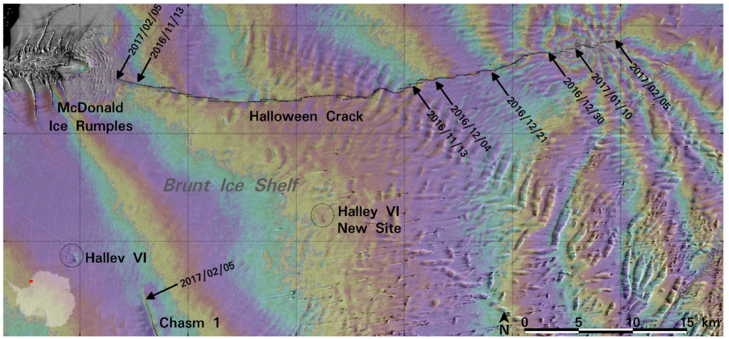
The calving of large icebergs is usually preceded by intermittent growth of cracks and rifts in an ice shelf that sometimes last for many years. In this project we will explore new methods of using satellite data for monitoring the development and propagation of ice shelf cracks to provide information that is key for investigating ice shelf evolution and the iceberg calving cycle. Sentinel-1 is now continuously acquiring data of the majority of the Antarctic coast, thereby providing observations over most ice shelves every few days. In this project these data will be used to derive ice flow velocity and to monitor crack propagation.
Calving front Location, Ice Shelf Area & Area Change
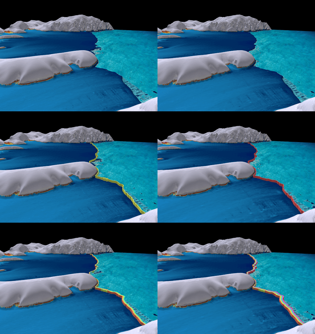
In recent years large calving events have reshaped the Antarctic coastline drastically. The ice shelf calving front is a highly dynamic environment that is continuously changing as ice from the interior ice sheet is transported to the ocean and icebergs break off. Whether the calving front location is advancing or retreating depends on many factors including oceanic, atmospheric and internal dynamic forcing. In this project we will further exploit new methodology to acquire valuable new datasets of the CFL and ice shelf area change using CryoSat-2 and Sentinel-1 data. This is important for computing the ice shelf mass balance, for estimating the iceshelf freshwater budget, for studying calving processes and their driving forces, or as indicators of changing ocean and structural conditions as potential precursors for dynamic instability.
Grounding lines
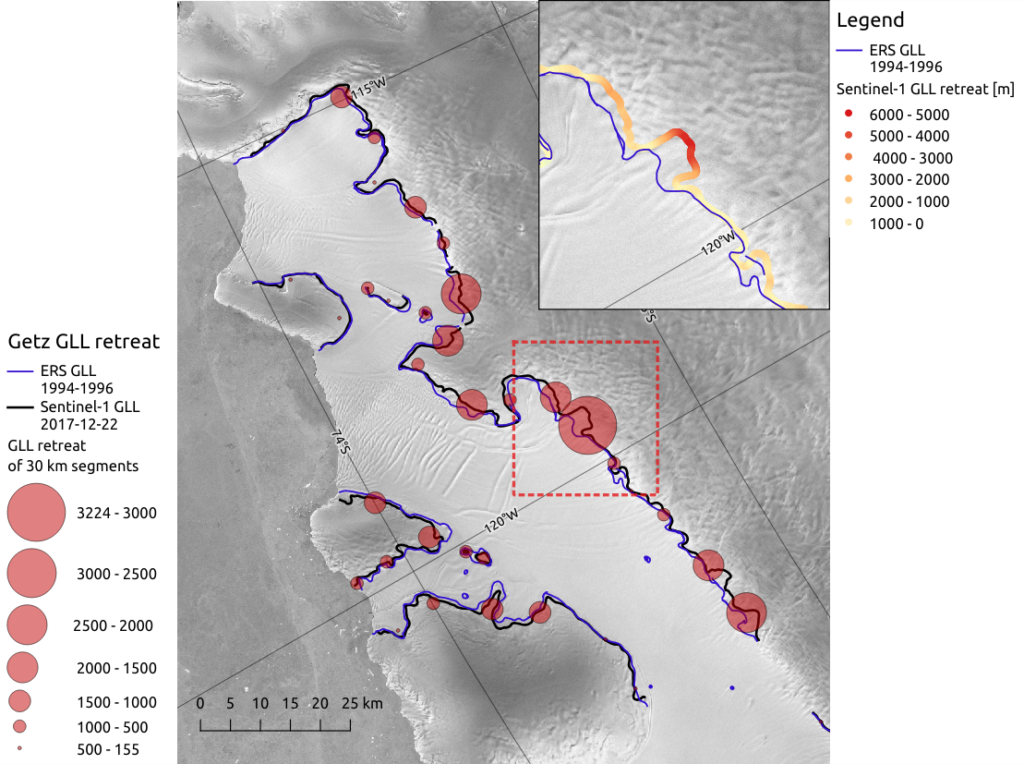
While the calving front is taken as the boundary between the ice shelf and the ocean, the ice shelf’s inland border to the grounded ice of the Antarctic continent is given by the grounding line. This project will take advantage of the processing chain developed in the ESA CCI/CCI+ Antarctic Ice Sheet project (AIS_cci) to derive the upper limit of ice shelf tidal flexure with means of double difference InSAR. A methodology will be developed to combine Grounding Line Location (GLL) AIS_cci products derived from Sentinel-1 A/B with contemporaneous Cryosat-2 based CFLs to obtain time series of complete ice shelf delineations and the resulting area change.
Melt detection using L-band brightness temperatures
Passive microwave radiometry has long been used to detect surface melt over ice sheets and seasonal snow. The launch of the SMOS satellite by ESA in 2009 provides an opportunity to explore melt processes at a new microwave frequency band. Due to the high penetration of low-frequency microwaves in ice (up to hundreds of meters), L-band observations offer the opportunity to detect melt processes beyond the surface. Over the unique environment of the ice sheets, this may offer the possibility to separate surface melt and basal processes. We will explore SMOS signatures over chosen test areas, exploiting the multi-angular nature of SMOS observations to reconstruct estimates of the signals’ origin. These will be analysed against other Polar+ Ice Sheets products, including basal melt.

